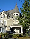
[ 3] Name on the Register
Image
Date listed[ 4]
Location
City or town
Description
1
Adirondack Forest Preserve Adirondack Forest Preserve October 15, 1966 (#66000891 ) NE New York State 43°58′43″N 74°18′42″W / 43.978611°N 74.311667°W / 43.978611; -74.311667 (Adirondack Forest Preserve ) Adirondack State Forest Preserve
2
Chamberlain Benjamin House Chamberlain Benjamin House August 12, 1999 (#99000989 ) 100 Market St. 43°00′15″N 74°22′22″W / 43.004167°N 74.372778°W / 43.004167; -74.372778 (Chamberlain Benjamin House ) Johnstown
3
Dolge Company Factory Complex Dolge Company Factory Complex September 17, 1974 (#74001238 ) S. Main St. 43°06′07″N 74°46′09″W / 43.101944°N 74.769167°W / 43.101944; -74.769167 (Dolge Company Factory Complex ) Dolgeville
4
Downtown Gloversville Historic District Downtown Gloversville Historic District September 12, 1985 (#85002367 ) Roughly bounded by Spring, Prospect, E. Fulton, N. and S. Main and Elm Sts. 43°03′03″N 74°20′43″W / 43.050833°N 74.345278°W / 43.050833; -74.345278 (Downtown Gloversville Historic District ) Gloversville
5
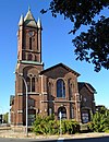
First United Methodist Church First United Methodist Church February 20, 1998 (#98000128 ) 7 Elm St. at Bleecker Sq. 43°03′07″N 74°20′48″W / 43.051944°N 74.346667°W / 43.051944; -74.346667 (First United Methodist Church ) Gloversville
6
Fulton County Courthouse Fulton County Courthouse July 24, 1972 (#72000841 ) N. William St. 43°00′24″N 74°22′32″W / 43.006667°N 74.375556°W / 43.006667; -74.375556 (Fulton County Courthouse ) Johnstown
7
Fulton County Jail Fulton County Jail October 19, 1981 (#81000404 ) Perry and Montgomery Sts. 43°00′11″N 74°22′16″W / 43.003056°N 74.371111°W / 43.003056; -74.371111 (Fulton County Jail ) Johnstown
8
Garoga Site Garoga Site July 22, 1980 (#80002613 ) Address Restricted Ephratah
9
Gloversville Armory Gloversville Armory March 2, 1995 (#95000081 ) 87 Washington St. 43°03′00″N 74°20′26″W / 43.05°N 74.340556°W / 43.05; -74.340556 (Gloversville Armory ) Gloversville
10
Gloversville Free Library Gloversville Free Library May 24, 1976 (#76001219 ) 58 E. Fulton St. 43°03′01″N 74°20′36″W / 43.050278°N 74.343333°W / 43.050278; -74.343333 (Gloversville Free Library ) Gloversville
11
Hotel Broadalbin Hotel Broadalbin May 4, 2011 (#11000252 ) 59 W. Main St. 43°03′24″N 74°11′57″W / 43.056667°N 74.199167°W / 43.056667; -74.199167 (Hotel Broadalbin ) Broadalbin New listing; refnum 11000252
12
Johnson Hall Johnson Hall October 15, 1966 (#66000520 ) Hall St. 43°00′54″N 74°22′58″W / 43.015°N 74.382778°W / 43.015; -74.382778 (Johnson Hall ) Johnstown
13
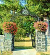
Johnstown Colonial Cemetery Johnstown Colonial Cemetery March 9, 1998 (#98000129 ) Jct. of W. Green and N. Market Sts. 43°00′30″N 74°22′23″W / 43.008333°N 74.373056°W / 43.008333; -74.373056 (Johnstown Colonial Cemetery ) Johnstown
14
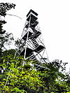
Kane Mountain Fire Observation Station Kane Mountain Fire Observation Station September 23, 2001 (#01001033 ) Kane Mountain 43°10′29″N 74°31′04″W / 43.174722°N 74.517778°W / 43.174722; -74.517778 (Kane Mountain Fire Observation Station ) Caroga
15
Kingsboro Historic District Kingsboro Historic District February 24, 1975 (#75001190 ) Area surrounding Kingsboro Ave. Park to N side of cemetery and S to include both sides of Gregory St. 43°04′01″N 74°20′12″W / 43.066944°N 74.336667°W / 43.066944; -74.336667 (Kingsboro Historic District ) Gloversville
16
Klock Site Klock Site July 22, 1980 (#80002614 ) Address Restricted Ephratah
17
Knox Mansion Knox Mansion February 28, 2008 (#08000101 ) 104 W. 2nd Ave. 43°00′02″N 74°22′28″W / 43.000556°N 74.374444°W / 43.000556; -74.374444 (Knox Mansion ) Johnstown
18
Gustav Levor House Gustav Levor House June 10, 2005 (#05000572 ) 23 Prospect Ave. 43°03′11″N 74°20′30″W / 43.053056°N 74.341667°W / 43.053056; -74.341667 (Gustav Levor House ) Gloversville
19
Log Cabin Church Log Cabin Church March 18, 1999 (#99000350 ) 413 Progress Rd. 43°02′35″N 74°17′33″W / 43.043056°N 74.2925°W / 43.043056; -74.2925 (Log Cabin Church ) Mayfield
20
Northville Historic District Northville Historic District May 7, 2014 (#14000191 ) Roughly Main, Division & Bridge Sts. 43°13′13″N 74°10′18″W / 43.220351°N 74.1717107°W / 43.220351; -74.1717107 (Northville Historic District ) Northville Historic core of lower Adirondack town
22
Oliver Rice House Oliver Rice House February 10, 1995 (#95000046 ) Old NY 30, E side 43°06′00″N 74°16′40″W / 43.1°N 74.277778°W / 43.1; -74.277778 (Oliver Rice House ) Mayfield
23
Oppenheim and St. Johnsville Union Society Church Upload image July 19, 2010 (#10000485 ) 110 County Highway 108 43°02′27″N 74°43′16″W / 43.040833°N 74.721111°W / 43.040833; -74.721111 (Oppenheim and St. Johnsville Union Society Church ) Crum Creek vicinityNew listing; refnum 10000485
24
Sacandaga Railroad Station Sacandaga Railroad Station March 7, 2003 (#03000094 ) 136 McKinley Ave. 43°13′01″N 74°11′09″W / 43.216944°N 74.185833°W / 43.216944; -74.185833 (Sacandaga Railroad Station ) Sacandaga Park
25
Godfrey Shew House Upload image July 12, 2006 (#06000574 ) 1632 S. Shore Rd. 43°08′43″N 74°07′26″W / 43.145278°N 74.123889°W / 43.145278; -74.123889 (Godfrey Shew House ) Fish House
26
St. John's Episcopal Church St. John's Episcopal Church September 24, 2004 (#04001054 ) 1 North Market St. 43°00′24″N 74°22′24″W / 43.006667°N 74.373333°W / 43.006667; -74.373333 (St. John's Episcopal Church ) Johnstown
27
US Post Office-Johnstown US Post Office-Johnstown May 11, 1989 (#88002337 ) 14 N. William St. 43°00′26″N 74°22′27″W / 43.007222°N 74.374167°W / 43.007222; -74.374167 (US Post Office-Johnstown ) Johnstown
